
ARTICLE: Opening the Floodgates
How a corner of Belgium stayed free from occupation in WW1

Anyone with a basic grasp on WW1 has heard about the First Battle of Ypres. I glossed over this at the beginning of the General Barbot fangirl piece a couple of weeks ago: but that battle’s the one where the Race (not) to the Sea has levelled out near the Channel and the Germans are hell bent on smashing their way through to the ports facing Britain. The line ruptures, General Fitzclarence sends in the Worcesters and disaster is averted. All of these things happened, yes, but once again, anglophone readers have cast the British Expeditionary Force front and centre of events, and that isn’t quite fair…
Just as important, just as fraught and just as desperately ‘won’ was the Battle of the Yser, which covered the bit north of the battlefront at Ypres all the way to the Belgian coast. For this, I’ve pulled up an account by Commandant Robert Thys, who played his own heroic part in trying to stop the Germans in autumn 1914. He describes this very low-lying battlefront like this:
From the upper reaches of Dixmude to its mouth, the Yser flows through land, most of which has been reclaimed from both the sea and the marshes by the stubborn labour of the Flemish peasant; this "breaking up,” begun in the Middle Ages by successive dams, has given us the lush region of the Polders, whose hydrography is made up of a tight network of drainage or supply channels into which the numerous streams that drain the waters of the region flow. Normally, the "Wateringues" service evacuates this water at low tide using an extremely complicated system of locks, sluices or dams. The entire network ends at Nieuport at a common channel, the mouth of the Yser, into which six main waterways open.
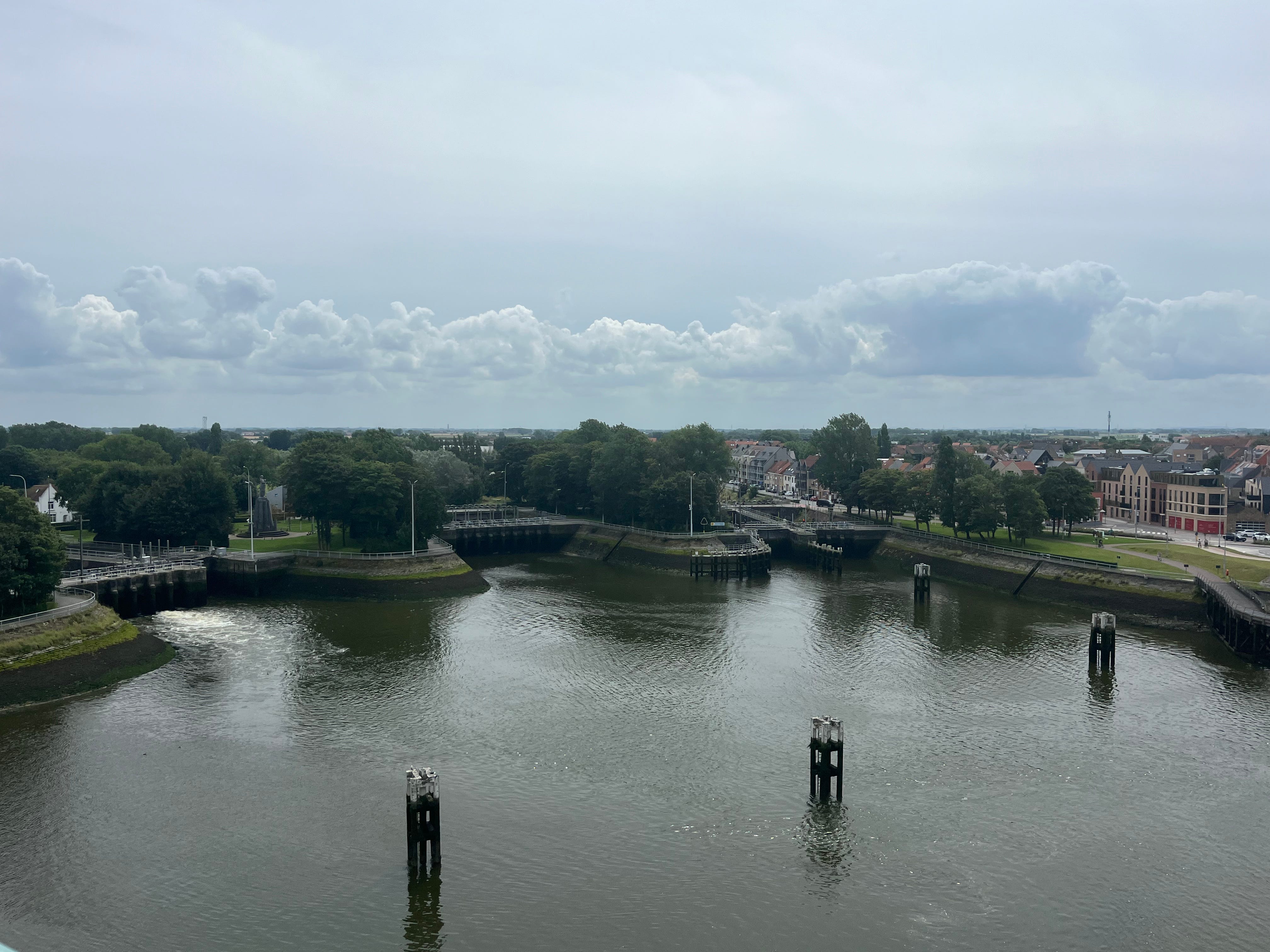
This is what the confluence of all this water looked like splaying out in multiple directions at Nieuport when I was there last week.
What happened here? The most clickbaity version goes a little something like this…
Keep reading with a 7-day free trial
Subscribe to Alex Churchill’s HistoryStack to keep reading this post and get 7 days of free access to the full post archives.